More actions
Created page with "thumb|right The '''Heyalar t’L’langon''' are Vulcan's largest and oldest mountain range, separating [[Shi'All] and Kir from Khomi, and ..." |
No edit summary |
||
| Line 1: | Line 1: | ||
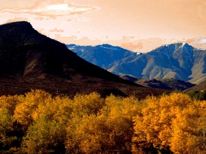
[[Image: | [[Image:Kir - Llangon foothills.jpg|thumb|right|Llangon foothils, [[Kir]] ]] | ||
The '''Heyalar t’L’langon''' are Vulcan's largest and oldest mountain range, separating [[Shi'All] and [[Kir]] from [[Khomi]], and [[Gol]] from [[Khomi and [[ | The '''Heyalar t’L’langon''' are Vulcan's largest and oldest mountain range, separating [[Shi'All]] and [[Kir]] from [[Khomi]], and [[Gol]] from [[Khomi]]. The stretch from the [[Thanar Sea]] coast in the east to Mount Kolinahr, where they join with the '''Heyalar t’Gol'''. | ||
The highest peak is Mount [[Tar'Hana]], an active volcano roughly 400 kilometers southeast from [[Shi'Kahr]. East of Tar'Hana lies a region called Ah'firr. While small as far as mountains go and with no significant peaks, the area is littered with a labyrinth of gorges and caves; and has long served as a natural barrier between [[Khomi]] and [[Kir]]. The Ah'firr region receives more rainfall than any other region in eastern [[Na'Nam]], with some portions receiving upwards of 800ml of precipitation per decade. | |||
Central Llangon is heavily forested, with the northern slopes covered in [[Ic'tan]] conifers and [[Indu'kah]]. The southern slopes are steep and craggy, but with a number of plateaus that exist at heights of 500–1,100 meters. | |||
The central southern part of the Heyalar t’L’langon lying at an altitude of 1,800 meters and above, separates [[Khomi]] from [[Kir]] and reaches towards the '''Tchol t’Glu'mas''' (Deep Sea Bay). This area is mostly a high desert, though the southernmost part tapers off into montane savannahs. | |||
Revision as of 08:52, 4 November 2015

The Heyalar t’L’langon are Vulcan's largest and oldest mountain range, separating Shi'All and Kir from Khomi, and Gol from Khomi. The stretch from the Thanar Sea coast in the east to Mount Kolinahr, where they join with the Heyalar t’Gol.
The highest peak is Mount Tar'Hana, an active volcano roughly 400 kilometers southeast from [[Shi'Kahr]. East of Tar'Hana lies a region called Ah'firr. While small as far as mountains go and with no significant peaks, the area is littered with a labyrinth of gorges and caves; and has long served as a natural barrier between Khomi and Kir. The Ah'firr region receives more rainfall than any other region in eastern Na'Nam, with some portions receiving upwards of 800ml of precipitation per decade.
Central Llangon is heavily forested, with the northern slopes covered in Ic'tan conifers and Indu'kah. The southern slopes are steep and craggy, but with a number of plateaus that exist at heights of 500–1,100 meters.
The central southern part of the Heyalar t’L’langon lying at an altitude of 1,800 meters and above, separates Khomi from Kir and reaches towards the Tchol t’Glu'mas (Deep Sea Bay). This area is mostly a high desert, though the southernmost part tapers off into montane savannahs.
